Historical website restoration from a legitimate Wayback Machine capture.
Archived actions are inactive.
Stevens & Permanente Creeks Watershed Council
Helping the Steelhead to Return
Album list
FAQ
Register
Login
Last uploads
Last comments
Most viewed
Top rated
My Favorites
Search
Home
>
Our Watershed
>
Water Quality
>
Stevens Creek Sites
>
USGS Gauging Station-Chestnut area
FILE 6/145
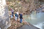
New Site between dam and feeder creek
Rate this file
(No vote yet)
File information
Filename:
023_20.JPG
Album name:
creekman
/
USGS Gauging Station-Chestnut area
File Size:
814 KB
Dimensions:
1536 x 1024 pixels
Displayed:
0 times
URL:
/photos/displayimage.php?pos=-143
Favorites:
Add to Favorites